I recently replaced the fish finder on my bass fishing kayak. My buddy got a new 7" Garmin for his yak so I had to keep up with the Joneses.
I have a Lowrance Elite 4 Chirp on my one yak, an Elite 4 on another and I have a couple of big Garmins in my boat. So I have a little experience with a couple different brands. My previous boat had a Hummingbird that I really liked but it seems everyone will tell you the other big names are better.
The big Garmins bring some neat features such as integration via Ethernet and AIS tracking via a VHF radio connection. They are way overkill for a kayak and frankly cost as much or more than most high end yaks.
I did a little reading and decided to take the plunge with a 5" Hummingbird. I didn't feel the need to step up to a 7" screen as I wanted to get a full day of fishing on a battery including power pole use. I thought the Hummingbird Helix 5si was the unit for me and no other manufacturer could even come close to its features for the price point.
I used it for the first time this weekend and couldn't be more pleased with the results.
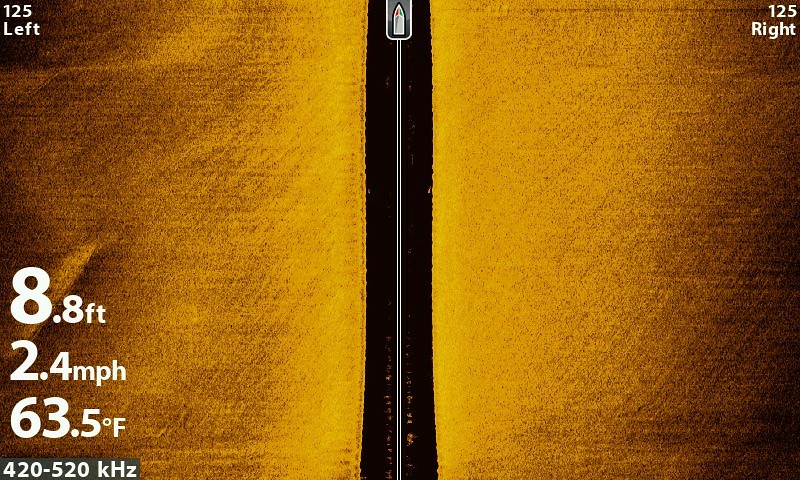
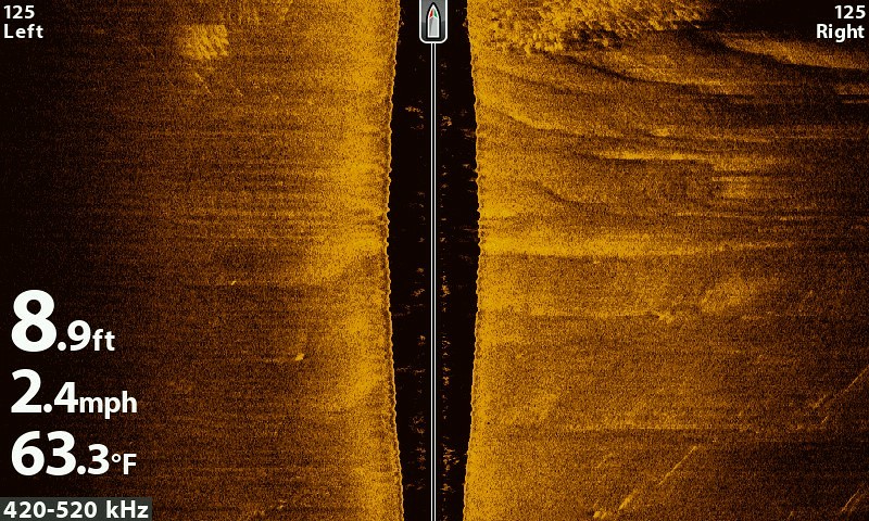
Here are a couple side imaging shots I got.
This is a sunken boat I went by.

Here are some fish stacked on some structure. There is no visible indication on the waters surface that any of the structure shown anywhere on this image exists.

Here is what it looks like as I go from a natural shoreline to a bulkhead.

This is the bulk head in the above image.

Another neat feature that the unit has is the ability to make a depth contour chart just by going over the area. You may notice some of the images have a contour chart in the right pane. These were drawn on the fly as I was paddling along. The two ponds I was at were not even on the map and now I have a detailed chart for these ponds.
Notice how detailed they are. These are old mill ponds and you can see square structures outlined. I assume these are old foundations. Being square they are obviously man made. I doubt anything naturally made would have all straight sides at 90 degrees of each other.


This image shows a raised foundation outline in one area and a square hole that is shaded a different color. I assume the square hole is an old basement or crawl space excavation. Notice how the hole and foundation are directly oriented to each other.

I can't stress how AWSOME this unit performed without even fiddling with any settings or even digging into the instructions. This was the first time I used it.
Another neat feature is being able to mark way points of structure via the side imaging. Simply locate the cursor on the object in the side image pane as you pass it and mark your submerged structure.
I'm sure other manufacturers make some similar functions in their units but not at a $400 price point.
Sent from my iPad using Tapatalk
I have a Lowrance Elite 4 Chirp on my one yak, an Elite 4 on another and I have a couple of big Garmins in my boat. So I have a little experience with a couple different brands. My previous boat had a Hummingbird that I really liked but it seems everyone will tell you the other big names are better.
The big Garmins bring some neat features such as integration via Ethernet and AIS tracking via a VHF radio connection. They are way overkill for a kayak and frankly cost as much or more than most high end yaks.
I did a little reading and decided to take the plunge with a 5" Hummingbird. I didn't feel the need to step up to a 7" screen as I wanted to get a full day of fishing on a battery including power pole use. I thought the Hummingbird Helix 5si was the unit for me and no other manufacturer could even come close to its features for the price point.
I used it for the first time this weekend and couldn't be more pleased with the results.
Here are a couple side imaging shots I got.
This is a sunken boat I went by.

Here are some fish stacked on some structure. There is no visible indication on the waters surface that any of the structure shown anywhere on this image exists.

Here is what it looks like as I go from a natural shoreline to a bulkhead.

This is the bulk head in the above image.

Another neat feature that the unit has is the ability to make a depth contour chart just by going over the area. You may notice some of the images have a contour chart in the right pane. These were drawn on the fly as I was paddling along. The two ponds I was at were not even on the map and now I have a detailed chart for these ponds.
Notice how detailed they are. These are old mill ponds and you can see square structures outlined. I assume these are old foundations. Being square they are obviously man made. I doubt anything naturally made would have all straight sides at 90 degrees of each other.


This image shows a raised foundation outline in one area and a square hole that is shaded a different color. I assume the square hole is an old basement or crawl space excavation. Notice how the hole and foundation are directly oriented to each other.

I can't stress how AWSOME this unit performed without even fiddling with any settings or even digging into the instructions. This was the first time I used it.
Another neat feature is being able to mark way points of structure via the side imaging. Simply locate the cursor on the object in the side image pane as you pass it and mark your submerged structure.
I'm sure other manufacturers make some similar functions in their units but not at a $400 price point.
Sent from my iPad using Tapatalk


Comment